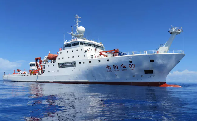
A marine research vessel runs a full parallel course of navigational work in open waters, which is only sampled from a navigational point of view; From a naval planning perspective, it may also acquire information on the depth of the seabed, acoustic transmission and currents required for submarine access to a strait. Can you distinguish between two ends? The United States Centre for Strategic and International Studies (CSIS) attempted to answer the question with long-term location data on 8 October, rather than looking at only one ship photograph.
The study team investigated 223 research vessels, comparing China ' s activities with 47 other countries, and comparing the auto-identification system (AIS) with the map of the seabed infrastructure with the journey from January 2020 to December
- The conclusion is that Chinese research vessels account for a significantly higher proportion of their time in the open sea submarine cables than in other important facilities. In 2024, seven Chinese research vessels were placed in the top 20 per cent of the time of their activities in the vicinity of infrastructure.
A ship close to a cable does not mean that it has been cut; However, the unusually intensive systematic survey of multiple years and locations is sufficient to constitute an early warning model for the maritime regulatory authorities to look at.
Why high seas mapping is more sensitive
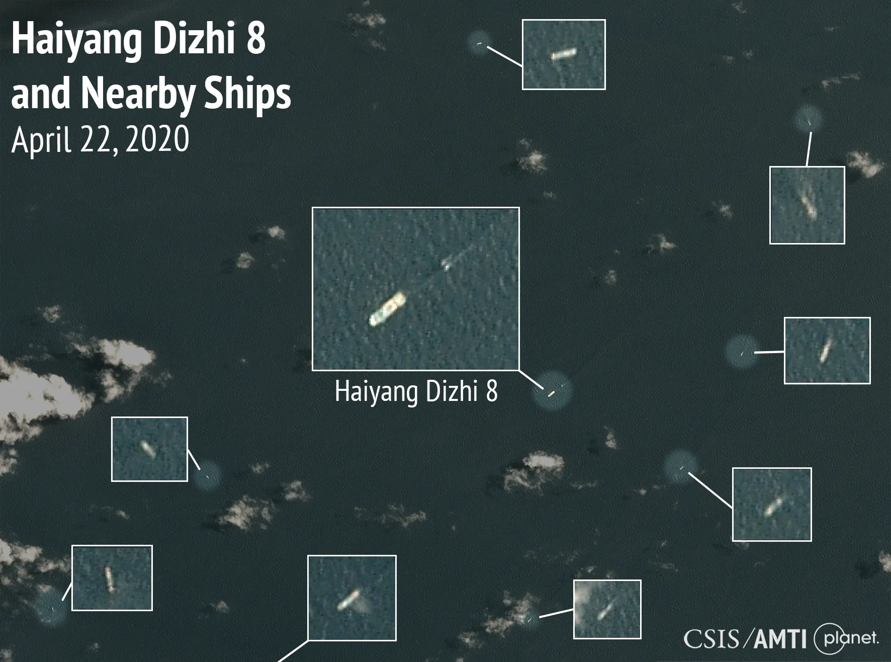
States have a legitimate interest in the peaceful conduct of marine scientific research. The salinity, temperature, current and seafloor topography of seawater are also indeed relevant to climate change, fisheries and safety of navigation. The problem is that the same data can also be used to calculate sound detection distances, plan submarine routes and select operational positions in the vicinity of the seabed equipment. Modern warships do not need to have a research vessel carrying weapons to gain military value from their measurements.
CSIS referred to the case of vessels such as Yinhong06, Science, and to an increase in activity in
- Reporting the development of a model of activities using ship tracks and spatial statistics, which does not directly determine from ship tracks that every scientist has received a military secret order. AIS may be closed and data gaps exist; Part of the normal investigation overlaps with the cables, and may also be determined by the terrain and course. These methodological limitations make disclosure of raw data and third-party verifications important.
Strategy for Yinghong, Science and the Seafloor
China has a long-standing link between State funding and dual-use technologies in the field of marine scientific research. High-precision mapping can be used in both open and military intelligence systems by academics. If research vessels have long conducted grid cruises near submarine cables on which international communications depend, it is desirable that national maritime agencies have access to ship research plans, sampling purposes and data disclosure.
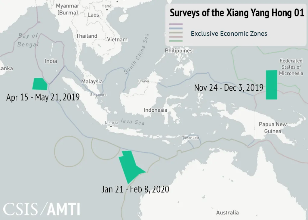
CSIS recommended joint maritime surveillance, cross-border law enforcement cruises and more regional cable repair vessels. These measures not only make a political statement to China, but also reduce the real impact of any State or perpetrator who destroys a sea cable. Weak sea cables resilience makes it easier to obtain strategic leverage for suspicious mapping.
Beijing describes research activities abroad as legitimate scientific cooperation and is opposed to Western maritime threat narratives. The legitimacy of scientific research should not be removed as a whole on the basis of nationality; Similarly, academic flags cannot exempt surveying vessels with national backgrounds from describing their repeated operations around critical facilities on the seabed.
On the surface, the traces of the ship ' s movement quickly disappeared; In the AIS database, several years of trajectory can accumulate into a pattern. If maritime transparency does not keep pace with measurement capabilities, those who have seabed data may first have the geographical advantage of the next crisis.
原始来源 · reuters.com路透社:台湾东部民兵船与研究船同期海上活动reuters.com ↗Long-term reveal of 223 research vessels, revealing the competition in seabed space
CSIS Future Laboratory uses the U.S. University of Delaware ' s International Research Ship Directory and Public Information on Ships to establish the initial list and to check the vessel species and maritime mobile operational codes (MMSI) with the MarineTraffic registry, resulting in the screening of 223 scientific research and related use vessels. The category of vessels includes not only research/measurement vessels but also fishing research vessels, submarines, special vessels and fishing patrol vessels. The research tracking period is 1 January 2020 to 9 December 2025, using data on the location of the General Atomics Optix platform AIS, and geo-graphic layers of the high seas against exclusive economic zones, submarine cables, submarine pipelines and potential mineral areas.
The key indicator here is not “how many ships have crossed the cables”, but the proportion of the voyage time observed by AIS that occurs in areas on the high seas that are adjacent to critical facilities on the seabed. The denominator is not all the voyage time on the planet, but the actual effective AIS trajectory time; If a ship closes AIS, signals are blocked or equipment is deployed underwater, the study may omit activities. The accuracy of the sea cables' position layer, the spatial buffer distance of the adjacent facility and the differences in the tasks of the different types of research vessels will also change the ratio, and the same calibre must be used for comparison.
20 per cent before the entry of seven Chinese ships in 2024: the correct meaning of the figure
CSIS reported that in 2024, seven Chinese research vessels exceeded 80 percentage points of the sample on the indicator “time of activity in the vicinity of critical facilities on the high seas”. That is, they enter the top 20 per cent of the target for ships, not seven of them that damaged the cables, let alone “70 per cent of Chinese science vessels that were spies”. The report also noted that most ships in this category were less than 1 per cent of the year ' s effective observation time, that American vessels were among the top 20 per cent of the five annual comparisons, and that Chinese vessels were present in four of them and in two of the Russian vessels.
This set of references is of considerable importance: the proximity of submarine cables is not unique to Chinese ships, and oceanographic research requires the measurement of seabed topography, currents and water temperature salinity. China ' s ship activity is significantly higher, which constitutes a national security risk trail; Additional information on command lines, ship-mounted equipment, mission letters or data recipients is required to prove that a particular flight is an AL-Ambassador reconnaissance mission.
How scientific research vessels, national scientific institutions and dual-use data are connected
The real activities of the research vessels are not just the tracks. The name of the ship, the type of ship, the scientific institutions to which it belongs, the relationship between the public measurement project and the State-funded network determines the technical and policy network for the entry of marine data. The information surrounding the seabed topography, hydrology and communications facilities has a clear dual-use attribute. When countries are able to bring together long-term scientific research into strategic systems, the economic and military values of ocean mapping may be channelled by the same set of authorities.
For Beijing, marine mapping has long been part of scientific capacity-building and may also be integrated into the dual-use strategic data system. As Chinese science and research vessels continue to operate near international submarine communications facilities, States are concerned not only with the single voyage but also with research into who ultimately holds the information and whether it enters military planning. (a) Communications cables are the infrastructure upon which global trade and public life depend; The accumulation of data in the name of scientific activity, without transparency in the mandate and the use of borders, inevitably deepens mistrust of the region ' s maritime security.
原始来源 · csis.orgCSIS原始研究:样本筛选、AIS平台、时空对比图与研究局限csis.org ↗
Article discussion
Verified members can discuss this report publicly and manage their own content.
Checking member sign-in status…